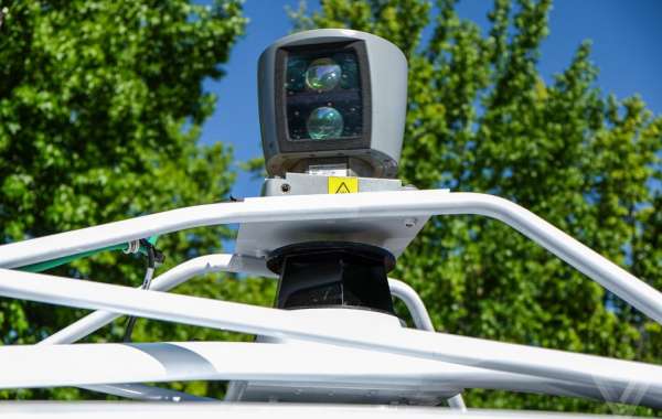
LiDAR and photogrammetry are two geospatial data acquisition techniques used in active and passive modes. Each has its benefits, and the possibilities are countless when used together. As they truly maximize the pixel-shading precision. This article is a case study of the use of modern data fusion techniques for efficient LiDAR and photogrammetry. Integration is presented, and the role of special targets for this task is considered.
Understanding LiDAR and Photogrammetry
LiDAR utilizes laser light to scan the ground and collect topographic data in the form of point clouds. That accurately describes the surface of the ground and any other structures. Photogrammetry, for instance, is accomplished by taking images of an object from different perspectives. They are then compiled and transformed into 3D models using highly developed computer applications.
LiDAR has strengths in collecting detailed ground elevation data and filtering through heavy vegetation. At the same time, photogrammetry benefits from highly detailed images with color variation. Combining these two methods makes it possible to take the best of both worlds. And achieve more complete and better quality geospatial information and data.
Technology and techniques
With the ever-growing advancement in technology, there are more sources of information. That is available and being generated every day. The fundamental question, therefore, is how do we make sense of all this information? Each technique, LiDAR and photogrammetry, brings relevant information. They also present certain drawbacks. While LiDAR data is highly precise, the resultant map may not contain color data and might fail to capture minute features. The use of photographs in photogrammetry provides much detail and color details. But often, depths are not as accurate when flying through mountains and canyons. Data fusion solves these problems by serving as a hybrid model that integrates some features of both methods.
Techniques for Data Fusion
Point Cloud Integration
LiDAR point cloud integration with photogrammetric point clouds is widely used. This process integrates the high-accuracy DEM data-derived LiDAR with the detailed surface texturing from photogrammetry. The result is a thorough, less distorted, noisy 3D model with the advantages of both datasets.
Image Superimposition
Another method is image superimposition, in which a photogrammetric image is placed on LiDAR data. This further enriches the LiDAR data with visuals, making the graphical representation more instructional. Special targets play a crucial role in data fusion processes. These are retro-reflective markers installed in the survey area for point identification in the LiDAR and photogrammetric datasets. For that matter, integrating both datasets requires that they point to the same targets. This way, geospatial professionals can attain higher accuracy in the interrelated models. Reflecting on the data alignment benefits that LiDAR GCP targets bring, their use will greatly increase.
Applications of Integrated Surveys
The enhanced data from integrated LiDAR and photogrammetry surveys has numerous applications.
Urban Planning
Combining LiDAR with photogrammetry makes it possible for city planners to make precise and accurate models of buildings. It helps in contemplating new structures, evaluating existing structures, and in general management of the growth of urban areas.
Environmental Monitoring
Integrating innovative data fusion for effective LiDAR and photogrammetry enables efficient environmental monitoring, such as determining the land's changes and distinguishing the land's utilization. This is very important when undertaking natural resource management. And understand changes in habitats and, perhaps, conservation plans efficiently.
Disaster Management
As already briefly mentioned above, topographical information is crucial in disaster management. Integrated surveys assist in relief operations, identifying areas prone to disasters and regions requiring evacuation routes. This way, separate data combines to form a stronger base from which response efforts are continually triggered.
Conclusion
Integrating LiDAR and photogrammetry is one of the major improvements toward geospatial data collection. Many professionals today have resorted to using LiDAR for elevation data and photogrammetry for imagery data. Using LiDAR targets as control points offers rich detail in the production of the 3D model. These models have vast implications, from urban dilemmas to disaster response policies.


